Greg James' GPS Marks for S.A.
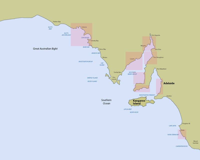
Please click on a section of the map above to obtain a list of Greg James' very own GPS marks for great fishing locations in our state, including some accessible by shore fishos! These spots are gleaned from Greg James' 50 years of fishing experience in our state, and are now available to you.
Also included are many of the artificial reef systems within S.A. which can make excellent locations for fishing. Since the mid to late 1980s PIRSA Fisheries has installed several artificial reefs to provide new fish habitats. Two different types of artificial reefs have been established:
- A tyre module reef designed by the South Australian Research and Development Institute (SARDI). Each module consists of 28 used car tyres strapped together into a tetrahedron and ballasted with concrete.
- Redundant barges or dredges, towed to selected sites and scuttled.
Several other artificial reefs have been installed by other organisations. Approval to install private artificial reefs must be sought in writing from PIRSA Fisheries as well as other authorities (e.g. Transport SA).
The location and type of each reef is listed on the appropriate page containing GPS fishing marks. The coordinates are based on Australian Geocentric Datum 1994 (GDA 94) which coincides almost exactly with WGS 84. Some adjustment may be required depending on GPS navigational system used.